Mapping Uncertainty. Early Modern Global Cartography, 21st Century Discussions
KNIR Colloquium
- Participation previous registration. Venue: KNIR
- Beginn: 11.05.2022
- Ende: 12.05.2022
- Vortragende(r): Kolloquium
- Ort: KNIR - Via Omero, 12, Roma, Lazio, 00196, Italië.

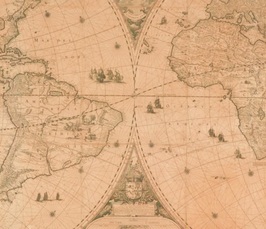
This workshop brings together experts on mapmaking. They confront each other with fascinating case studies from their own research, varying from world maps and globes to maps of Africa, Tibet, and the Dutch coast. Input from the fields of digital humanities and cartopology ascertains that we put centre stage the interaction between the people, the world, and the map.
The following scholars have confirmed their participation: Emily Mann (Courtauld Institute of Art / Bartlett School of Architecture, UCL), Isabel Casteels (KU Leuven), Diana Lange (Universität Hamburg), Weixuan Li (Huygens Institute for the History of the Netherlands / Universiteit van Amsterdam), Luis Lobo Guerrero (University of Groningen), Edward Mac Gillavry (Webmapper), Djoeke van Netten (Universiteit van Amsterdam), Sjoerd Ramackers (Universiteit van Amsterdam), Tim Soriano (Newberry Library, Chicago), Rombert Stapel (International Institute of Social History, Amsterdam), Chet Van Duzer (Lazarus Project, University of Rochester), Marlies Vermeulen (Dear Hunter / Institute of Cartopology).
Please register by sending an e-mail to secretary@knir.it (or follow THIS LINK)
Program
Wednesday, May 11
Start with coffee
9.30 Welcome by the KNIR
9.40 Introduction day 1 – Djoeke van Netten, Not Yet Known
10.30 Coffee break
11.00 Panel I. Maps of Doubtful Data.
Luis Lobo-Guerrero, Uncertainties in the Anonymous Chart of the Pacific coast of Central America to Northern Chile, ca. 1525.
Diana Lange, Mapping (Un)Certain Knowledge. The Case of Tibet.
Gianamar Giovanetti-Singh, Contrasting Cartographies of the Cape Colony, ca 1650-1800.
13.00 Lunch
14.30 Panel II. Maps of Metropoles and Colonies.
Emily Mann, Mapping London and its Empire in an Age of Doubt, Disaster and Distrust.
Sjoerd Ramackers, Mapping a Colony. The Map of Berbice by Jan Daniël Knapp (1742).
Weixuan Li, (Deep) Mapping Uncertainties of Artists’ Locations in 17th-century Amsterdam.
16.30 Break
17.00 Public event: How to Know What to Put on the Map?
Keynotes:
Tanja Michalsky, Diachronic Neighbourhoods. Challenges of Mapping the History of Naples.
Angelo Cattaneo, Handling and Shaping Uncertainty. Or Rather the Ontology of the Cosmographer, According to Fra Mauro.
18.30 Drinks
Thursday, May 12
Start with coffee
10.00 Introduction day 2 – Marlies Vermeulen, Moments of Cartopological Mapping
10.45 Short coffee break
11.00 Panel III. Maps and Writings.
Isabel Casteels, Navigating Uncertainty. Debates on Textual vs. Visual Maps and How to Draw them in the Dutch Republic, 1585-1600
Timothy Soriano, ‘A Brief Description of Afrike’. English Travel Writing and Renaissance Maps of West Africa
12.30 Lunch
14.00 Panel IV. Overcoming Uncertainty?
Chet Van Duzer, On Second Thought. Cartographic Corrections to the Shape of Africa on Medieval and Renaissance Maps.
Danielle Gravon, Erasure of Certainty. Mercator and Hondius at the Poles
Rombert Stapel, Messy Data, Messy Maps. Practical Observations – and Solutions – When Dealing with Uncertainty in Historical Data and Historical GIS.
16.00 Break
16.30 Concluding remarks / general discussion
17.30 Drinks
Scientific Organization: KNIR Colloquium by Dr. Djoeke van Netten (University of Amsterdam)